
Latvia Geography & Maps


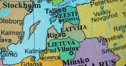
Latvia is an extension of the Eastern European plain on the shores of the Baltic Sea. It shares borders with Lithuania in the south, Estonia in the north, Russia in the east, and Belarus in the southeast. Forests cover approximately 41% of the country. Of this 41%, almost half are pine forests. A further 10% of Latvia’s territory is covered in peat bogs, swamps, and marshes. More than 12,000 rivers dot the landscape of Latvia, with major rivers including the Daugava, the Lielupe, the Gauja, the Ventra, and the Salaca. Along with the rivers are around 3,000 small lakes.
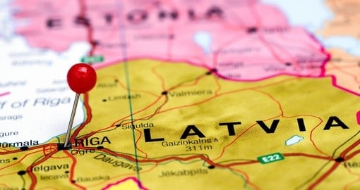
A relatively flat country, Latvia’s eastern landscape has some hills, the highest of which is Gaizinkalns at 311.6 m (1,022 ft). Latvia’s capital city is Riga, located on the Gulf of Riga at the mouth of the Daugava River. Riga is the largest city in the Baltics and is home to more than one-third of Latvia’s population.
Get a Trip Quote Order a Brochure