
Slovakia Geography & Maps


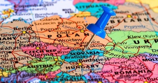
Slovakia is a landlocked nation in the middle of Europe. It shares borders with Czech Republic in the west, Austria in the southwest, Hungary to the south, Ukraine to the east, and Poland to the north. Slovakia is a relatively small country, but it hosts a variety of landscapes including lakes, forests, canyons, caves, mountains and more.
Approximately two-thirds of Slovakia’s land is covered by forests, making it one of the most forested countries in Europe. Another natural element that dominates the landscape in Slovakia is the Carpathian Arch, a range of mountains that cover the northern part of the country. With the Carpathian Arc are a series of smaller ranges: the Lesser Carpathians, the White Carpathians, the Lesser Tatra mountains, the Greater Tatras, the High and Low Tatras, and the Slovak Core mountains. At 2,655 m (8,710 ft), Gerlachovsky štit is the country’s highest peak and is found in the High Tatras.
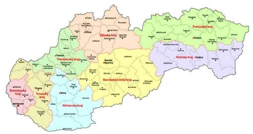
Bratislava is the capital of Slovakia. It is found in the southwestern corner, near the Austrian border. Bratislava serves as the political, cultural, and economic centre of the country. There are many universities found in the city as well as other educational and cultural institutions.
Get a Trip Quote Order a Brochure